Environmental Constraints Map – Site Analysis
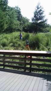
CLSI employs state-of-the-art GIS Technology as a reconnaissance tool to facilitate decision-making early in the planning process. “On-the-ground” preliminary field investigations of the project site verify the potential location of environmental features. Environmental Site Constraints Maps are produced suitable for feasibility studies incorporating Local, State and Federal regulatory buffers.
Wetlands & Streams

Joint Federal/State Wetland Permitting: With over 20 years of permitting experience our professional staff has successfully navigated both private and public sector projects through the Federal & State Wetland Permitting Process.
Non tidal Wetland and Waterway Delineations documented utilizing the 1987 U.S. Army Corps of Engineers Wetland Delineation Manual.
Mitigation & Monitoring: CLSI’s Environmental & Engineering staff also provide mitigation plans, emergency repair design, inadvertent violation support, monitoring and stream restoration plans.
Forest Conservation & Forest Bank Planning
Forest Stand Delineations and Forest Conservation Plans: Since the enactment of the Maryland Forest Conservation Act of 1991, CLSI has successfully prepared over 800 plans in four counties and is a leader in Forest Bank Establishment Planning and Management.
CLSI’s Qualified Professional Staff has over 20 years of private and public sector forest conservation and resource mapping experience.
Clients of CLSI benefit from an extended network of resource professionals specializing in forest management plans, pre-development harvesting, cultural resource and sensitive species management plans.
